City grid, plan & streets
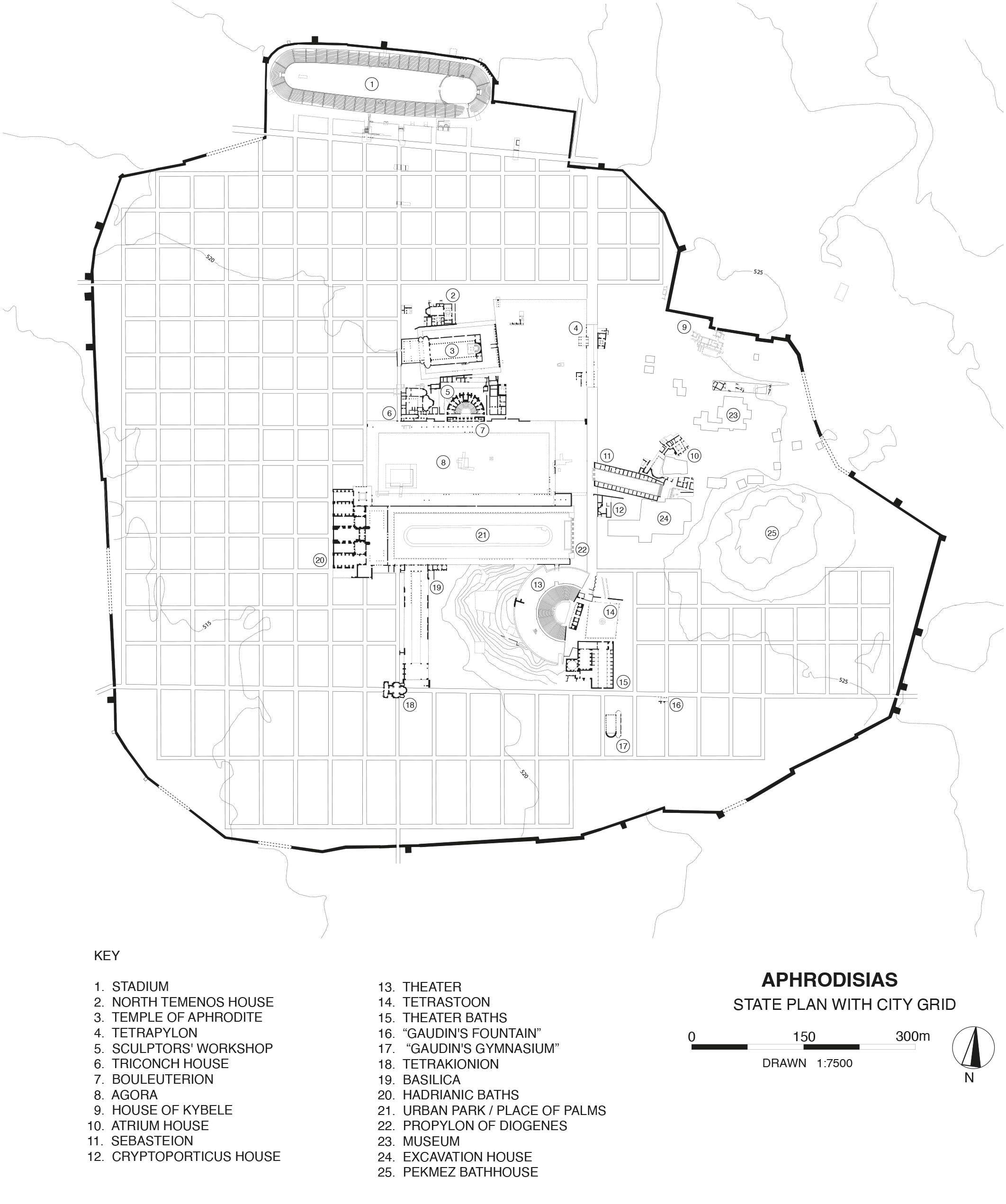

Aphrodisias was laid out on a new plan in the later hellenistic period, within which later urban development was determined. An orthogonal grid of urban blocks was laid out over the entire site on a north-south orientation, and the major public buildings of the city centre, including the Agora and the Urban Park, were designed to fit within this regular plan (see left). Individual city blocks measured 35.5 x 39 m (= 120 x 132 Roman feet) and were separated by streets 3.5 m wide (= 12 Roman feet). Individual housing units seem to have been 60 x 60 Roman feet. The grid was laid around the sanctuary of Aphrodite and the Theatre (both of which have different orientations), and an area of six blocks between the sanctuary and the Theatre was reserved for the Agora. An earlier, unplanned settlement may have occupied the area east of the Agora. This would explain the diverging orientations of the Sebasteion and Atrium House.